

As we all know, European integration not only involves the unification of currency with the Euro but also the abolition of borders between Schengen states.
Consequently, European countries must systematize the planning of their road network, especially the European highway, which has formed a systematic international road network known as the European road network.
Over the years, more and more cross-border European freeways have been built, and the road network now includes EU countries, the Council of Europe participating countries, and even Kazakhstan in Central Asia. These European freeway networks have established uniform road signs in most European countries, which are erected on and near the freeways.
Sweden, for example, has fully adopted the European road signs in the country. However, the UK, which is known for its isolationist tendencies, has not only failed to unify its currency but has also not set up any road signs before Brexit.
Meanwhile, Ireland has recently begun planning for the installation of certain signs on its roads, but these signs have yet to be standardized. International road networks similar to the European freeway network include the Trans-Asian Highway, the Pan-American Highway, and others.
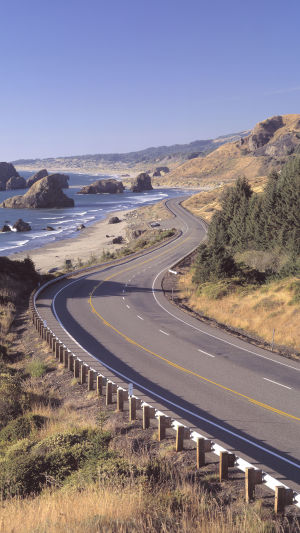
The Pan-American Highway is a highway system that runs through the entire American continent, starting from Alaska in the north, from the Arctic Circle, and extending south to Tierra del Fuego, the nearest continent to the South Pole.
This is not just a single highway but a network of highways that spans the entire continent. The Pan-American Highway is mainly divided into the northern route and the Southern route. The northern route runs through nine countries, namely Canada, the United States, Mexico, Guatemala, El Salvador, Honduras, Nicaragua, Costa Rica, and Panama.
In addition, the Pan-American Highway is linked to four other South American countries through feeder roads, namely Bolivia, Brazil, Paraguay, and Uruguay. The Pan-American Highway has a total length of approximately 48,000 kilometers, with a main route of nearly 26,000 kilometers.
The concept of the Pan-American Highway was proposed in 1923 at the Fifth International Conference of American States, and the first Pan-American Highway Conference was held in Buenos Aires in 1925.
Since then, the United States and Latin American countries have jointly planned and built this highway system. Surprisingly, Mexico was the first country to complete the construction of the Pan-American Highway within its borders, which was completed in 1950.
Another notable highway is the Alaska Highway, which connects the city of Three Ways, Alaska, USA in the north and runs south through the Yukon Territory to Dawson Creek, British Columbia, Canada. This highway is 2,232 kilometers long, and although the distance is quite long, the scenery along the way is breathtakingly beautiful.
In addition to the European and Pan-American highways, several other international road networks connect different countries and continents. One such example is the Asian Highway Network, which is a network of roads and highways that connect 32 countries in Asia and Europe.
The network covers a total distance of over 140,000 kilometers and is divided into 10 different routes.
International road networks have greatly benefited our modern society, facilitating trade, travel, and cultural exchange. The European road network, Pan-American Highway, and other similar networks have greatly improved the connections between countries and regions, making it easier for people to explore the world and discover new cultures.